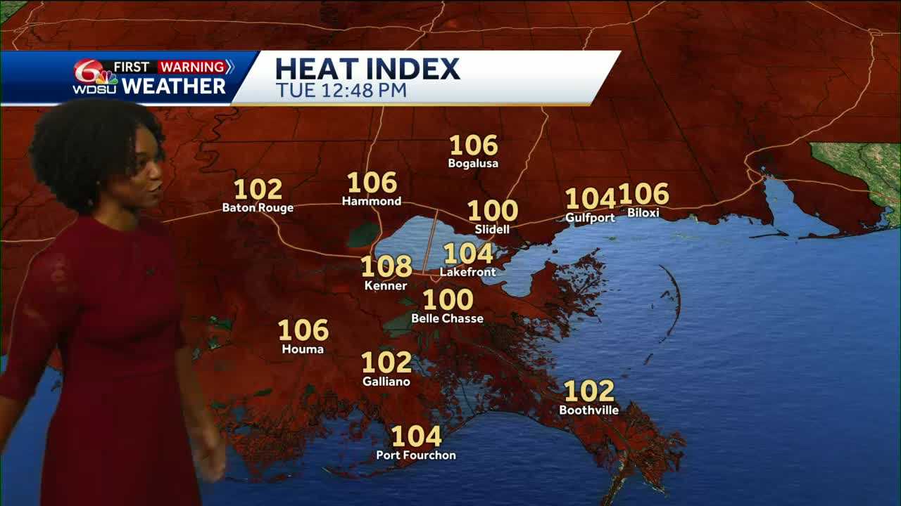
Today is another WDSU First Warning Weather Impact Day due to another Heat Advisory today. An EXTREME HEAT WARNING has been issued for Wednesday as highs reach the mid 90s, feeling hotter than 110.
Afternoon highs rise to the mid 90s, feeling like 108–112° in some spots.
Storm chances remain low today, but a few isolated showers or thunderstorms could pop up along lake breeze boundaries, especially south of I-10. Most areas will stay dry.
Wednesday could be the hottest day of the week! There is an Excessive Heat Watch in effect, but it could get upgraded to a warning. We could possibly feel like 110–115°.
Rain chances increase starting Wednesday afternoon. The upper high that’s been sitting overhead begins to slide away, allowing more tropical moisture to move into the region, meaning more rain Thursday and Friday.
There are early indications of heavy rain as Thursday and Friday both have risk for flash flooding.
Temperatures are also set be cooler or return to average as the rain moves in.
READ MORE:IMPACT DAY: Heat Advisory Today with Dangerous Feels-Like Temps, Rain Chances Return Midweek


