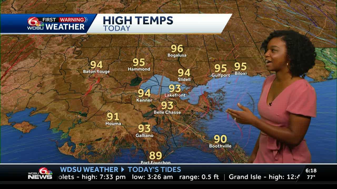
It’s another WDSU First Warning Weather Impact Day across Southeast Louisiana as dangerous heat and humidity continue. A Heat Advisory is in effect through 7 PM, with high temperatures in the low to mid-90s and feels-like temperatures between 105° and 110°.
A few scattered storms are possible this afternoon, especially near outflow boundaries. Any storm that develops could produce brief heavy rain, gusty winds, and frequent lightning. Storm coverage will be more isolated compared to Monday.
Watching the Tropics:
The National Hurricane Center is monitoring a disturbance east of Florida that’s moving into the northeastern Gulf. Development chances have increased to 40%, but even if it doesn’t strengthen, it could still bring heavy tropical moisture into our area by Thursday and Friday.
That could mean:
- Higher rain chances
- Flash flooding potential in low-lying or poorly drained areas
We’ll continue to monitor how this system evolves and what it could mean for Southeast Louisiana heading into the weekend. For more on the tropics, click here.
READ MORE:Impact Day: Heat Advisory Continues Today | Tracking Gulf System for Late Week Rain


